|
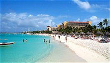
We had a pleasant night sail to Aruba, though the view of the oil refineries at night, with their huge
flares, and the strong smell and black smoke, all seemed like an attempt at an impression of hell. We
were astonished to pass several cruise ships that night, apparently coming from, or past, Aruba (they
make life difficult for passing sailors, as they are festooned with bright lights, making it impossible to
see their navigation lights until they are too close, so it is hard when you first see them to tell in which
direction they are heading, and whether you want to move out of their way). We were even more astonished
when we arrived at the port, to discover several cruise ships docked there. It seems that the
attractions are casinos and shopping malls, rather than sight-seeing, but we chose to avoid them all and
stayed on the boat at anchor, waiting for the weather break.
After a couple of days, the forecast seemed to have
moderated slightly, although people reporting back on the radio seemed to be experiencing more wind than was
forecast, at least for a spell, so we prepared ourselves and Flame thoroughly for what we expected to
be a roughish trip of some 650 miles or so.
We stared out very well, with a pleasant sail for the first 24 hours, and the wind and sea gradually
increasing as we started to reach the notorious bit of sea. We had a boost from the west-going current, so
that we averaged nearly 7½ knots over the ground over the first 3 days. We had been advised to keep well
north of the coast, and not to be tempted to cut off the corner as you round the northwest corner of
Colombia, so we stayed well off shore, and while we were sailing pretty much due west, had a good sail,
despite the wind and seas. By the third night out, though, we had reached a point where we had to start
to turn south, and the sea really started to build, so that we had waves washing over us at too regular
intervals, twice completely filling the cockpit in the next 12 hours.
It was good to have the twice daily radio schedule to be in touch with friendly voices! In the mornings was
the local weather net, run by Alex, a Dane who has been in the Caribbean for many years, and in the
evenings a private check-in with our friends on Just Magic, who had decided to stay in Aruba with other
friends of theirs, in the hope of still lessening winds. We had concluded from all the advice that we
would have to wait for at least a month, and that as long as we kept out of the confused seas inshore, we
should cope.
And we did, though it was wet and uncomfortable, particularly for those 12 hours or so, when we had a
regular 30 – 35 knots of wind, with periodic gusts of 40 and on one occasion 50 knots. Alex’ forecast that
morning was for up to 30 knots (still more than we ideally prefer!) and we were eagerly awaiting the
moment when the wind would come down to that!
For the sailors among you, the most sail we had up was
the storm jib and an equivalent amount of furled genoa on the other side. For the rough 12 hours, we just
ran under storm jib. Cecile managed magnificently, though she did struggle during those 12 hours, as the
boat was not well balanced with just the storm jib, so we steered for most of that time. But we preferred to
make sure one of us was up on deck all the time anyway, to make sure all was well, so for 12 hours
that was fine.
The wind dropped for our fourth and final night at sea, but we needed to slow down, so as not to reach
the coast before dawn, as our destination was on the far side of reefs, and not lit. So we didn’t hoist
any more sail.
It was a good moment when soon after dawn, John
spotted the whale-like shape of Isla Pinos, one of the eastern-most of the San Blas islands. We had chosen
it as an easy to recognise landfall, and so it proved. It was still a slightly hairy entrance. The swell was
mounding up and breaking in waves on the reefs, and all the water sloshing around the cockpit had swamped
the echo sounder, so we couldn’t use it to tell us how deep the water was as we approached. Add to this that
the charts are known to be unreliable, the surveys old, coral grows anyway, and the fact that the guide
reports that there may be a rock in the entrance, and you will understand that our approach was quite
hesitant! However all was well, and as we rounded the south eastern side of the island to enter the
anchorage, we saw one other, Canadian, yacht and a Colombian trading boat in the bay.
We had our improvised lead line (a piece of line with knots tied every half fathom and a spanner as a weight
on the end) for checking a suitable place to anchor and were soon anchored and pleased to have arrived and
to have stopped!
The Canadian yacht, Stella, proved very friendly,
which was generous of them, since it is always nice to be the only boat in an anchorage – once there are two
or more, others don’t matter so much!
The San Blas islands are part of an autonomous reservation in Panama for the Kuna Indians, who are
believed to be the last of the original Carib people who inhabited the Caribbean before the Spanish and
other Europeans arrived.
The Kuna are famous for having been particularly
successful at guarding their culture and traditions against the encroaching modernism from “outside”,
although this is apparently less the case the further west one goes. This was one of the reasons that we
wanted to come down to Isla Pinos. The Kuna area in Panama has long been designated an autonomous reserve,
with a Panamanian governor, but most affairs left to the Kuna to regulate for themselves. They occupy an
archipelago of small islands stretching about 100 miles along the Panamanian coast just west of the
Colombian border towards Colon, and a strip of the
adjacent mainland.
We had read that we would have to present ourselves to the village chief, or Saila, and offer a gift of
coffee, sugar, or the like, and that some villages had started to ask for a small payment instead. Stella
had received a visit by canoe and a brief the previous afternoon, informing them that they should go to meet
the Saila and make a payment of USD 6 to stay in the anchorage off the village. Their complement consisted
of the Canadian owners, Terry and Ariel, and their friends Pepe and Marie. Pepe had been born and
brought up in Mexico, but hadn’t spoken Spanish for decades until they decided to cruise down the
Colombian coast, instead of taking the offshore passage as we did. There he found his Spanish
returning, and we were pleased to be able to join them for Pepe’s translations.
We met the Saila, with little ceremony, paid our dues
and were shown round the village by Senor Suarez, whose job in the village it is to act as interpreter
to visitors and storyteller for the village. He spoke some English, but fluent Spanish (the local language
is Kuna). The village housed some 230 people, all in wooden-framed houses with walls made of bamboo poles
loosely laced together to let the air through and roofs of a particular type of palm tree, specially
folded to make a substantial thatch (necessary in a part of the world with a very high annual rainfall).
They are built on sand, and essentially furnished with colourfully woven hammocks and the occasional plastic
garden chair, looking rather out of place. Senor Suarez kept his library of photos of previous visitors
and his Spanish English dictionary on one of the joists, presumably to keep them safe from ants. We
later noticed that all the family’s clothes were also hung over the joists. Each house had its own little
“yard” protected by a palisade of bamboo. There was no electricity in the village, except for solar power
to run two Cable and Wireless phone boxes; the baker used a gas oven and the shop sold chilled drinks
courtesy of a gas fridge. The Kuna have a community policy, as we understood it, so that some individuals
do not become rich while others remain poor. Despite the basic living conditions, there was no feeling of
poverty, and indeed Senor Suarez had returned from working in Panama City to live in Tupak, “because
there were too many poor people there”.
Fishing seemed to be one of the main “industries”, and the only local form of transport is canoes made from
hollowed out single logs, and powered in Isla Pinos at least, by a single paddle, or occasionally two
paddles, and a small sail when possible.
The Kuna are adept at promoting their culture to
visitors, but we couldn’t help noticing a number of paradoxes which will no doubt over time create
tensions in the maintenance of such a different way of life even to the rest of Panama.
The mainstay of the income to Kuna villages must undoubtedly be the craft of mola making by the women.
Molas are intricate pieces of appliqué and reverse appliqué which the women traditionally use to decorate
the fronts and backs of their blouses. The patterns are often geometric, or represent the local flora and
fauna in a compelling, slightly primitive artistic style. There is nothing at all primitive in the
workmanship however, and the intricate patterns and fine stitching of the appliqué, sometimes highlighted
by tiny embroidery stitches is quite extraordinary.
In some village anchorages, one is apparently
inundated with canoes approaching to try to sell molas, but in Isla Pinos the Saila had decreed that
no-one was to try to sell molas individually. When (not if) visitors decided they would like to but
molas, the women of the village would assemble to lay out their wares so that the whole affair could be
suitably business-like. This was of course an attractive option for us – not only the absence of
canoes touting for business, but the opportunity to see a wide range of work before buying. When we got
together with Stella for this purpose, we were taken to the village “hall” to wait in the shade, while one
man walked round the village calling to all the women to come and display their wares, just like a town
crier.
In practice we had already been offered molas by Senor Suarez and by the (only) family living in the bay by
the anchorage, so we had seen a number before this However, we were able to choose several designs of
fish, a turtle and some frogs, which not only appealed to us but which we can envisage as cushion covers at
home!
Such was our experience of Isla Pinos. Moving on up
the coast, we decided, due to lack of echo sounder combined with still high winds causing heavy swell, to
take the outside route round the reefs, and finished up unexpectedly having to beat up the coast overnight.
However, arriving at Green Island made it worthwhile again. This anchorage was partly behind a small
uninhabited island and partly sheltered by a wide reef, just under the water, so that you could see the
waves breaking to windward some way from the anchorage across “open” water, but the anchorage itself was
completely still. Quite a change from the anchoring we have been used to, behind headlands or in bays
where you can see the shelter clearly!
This was a delightful spot, slightly marred by the canoes arriving to demand we buy molas, with a lovely
walk round the island on white sand under the palm trees. We also found, for those of you who are
Microsoft Powerpoint users, the model for the desert island so often used in Powerpoint presentations!
It was at this island that Just Magic and Capers
arrived from Aruba a couple of days later. They had waited in the hope of improving weather, but
unfortunately had still encountered similar seas and winds to us and were pleased to make landfall in such
surroundings.
Imagine a small island about 150 yards long and 50 yards wide covered with palm trees. On the north side,
the remains of Atlantic rollers end their journey, having crossed the Caribbean sea, by crashing
themselves onto a coral reef almost 250 yards wide. The constant sound day and night of the crashing waves
predominates. From dark grey the sea colour changes to dark blue and thence lighter as the water depth
shallows until the most amazing azure blue meets the white fine sand. And in the shallows as we strolled
around our almost private desert island, huge starfish with beautiful colours lay among the seagrass on the
seabed.
Sadly the schedule dictates that we move on towards
the end of our first ocean crossing to Panama and across the continental divide into the Pacific.
One more island in the San Blas chain, Chichime, to visit. More thunderous waves crashing onto reefs,
more thrilling colours in the sea, and we even managed to take the dingy up to within a few yards of where
the reef begins and the surf ends. The wind never seems to diminish, maintaining a constant 20 to 25
knots.
Without a working echo sounder we had been nervous
about taking the inside route to Panama however our friends on Just Magic lent us their handheld one and
we were able to wend our way around and inside the reefs and shallows to the rather frightening entrance
to Isla Grande. There are only 25 yards between the island rocks and the reef, with a large swell and some
breaking waves in the channel. Any normal risks would seem tame compared to this entrance, with no chance to
turn around, waves 10 feet high seeming prepared to crash down upon Flame, and a reported 3 knots of
current. Strange houses painted in bright colours lined the channel, with a small naval boat at anchor,
but there were too many people for us so we went on to
Isla Lynton.
In the morning we had just 25 miles to Colon. Past Drake Island off Portobelo (which he tried
unsuccessfully to sack just before he died) with a reputed annual rainfall of 240 inches, rolling past an
enormous oil refinery and avoiding an isolated rock 1 mile to the west of the entrance, and we arrived off
the eastern breakwater and requested permission from the port authority for Flame to enter the port.
One of the joys of ocean cruising is the excitement of
entering a new port, one of the banes of ocean cruising is the entry formalities dreamt up by
nameless bureaucrats anxious to capture files of the dullest nature known to man at the expense of the
yachtsman’s time. Added to this the procedures needed to transit the canal itself (there being no difference
between the process for a 500,000 ton tanker and 12 ton Flame) a couple of days slowly pass until one can
consider oneself legally admitted to the country and free ? to attend to the needs of the yacht in
preparation for the 9000 mile Pacific crossing. This assumes that we survive the canal transit itself as we
learn that two days after our arrival two yachts were very badly damaged in the first lock, when they were
sandwiched between the tug they were tied to and the stern of the ship ahead of them. Both were
dis-masted and one hull is so badly damaged that it is understood to be a write-off .
Meanwhile having been warned of the dangers of being mugged in Colon we take taxis into the town and walk
nowhere except in large groups. Fortunately the Panama Canal Yacht Club provides a small secure haven
and an air-conditioned café as a relief from the humidity and heat which exceeds 85 to 90 degrees. We
may be delayed for a week awaiting the transit and then we shall be setting sail for the Galapagos.
There is a live web cam on the penultimate lock, (www.pancanal.com) but since we are constantly
re-scheduled backwards, it is hard to say on which day we will be there, let alone at what time. Also, in
those big locks, not much of us will be visible!
John & Helen
Fleming
Flame of Gosport
8 March 2001
|